OUR SERVICES

UAV & Mapping Services

AERIAL UAV
SERVICES

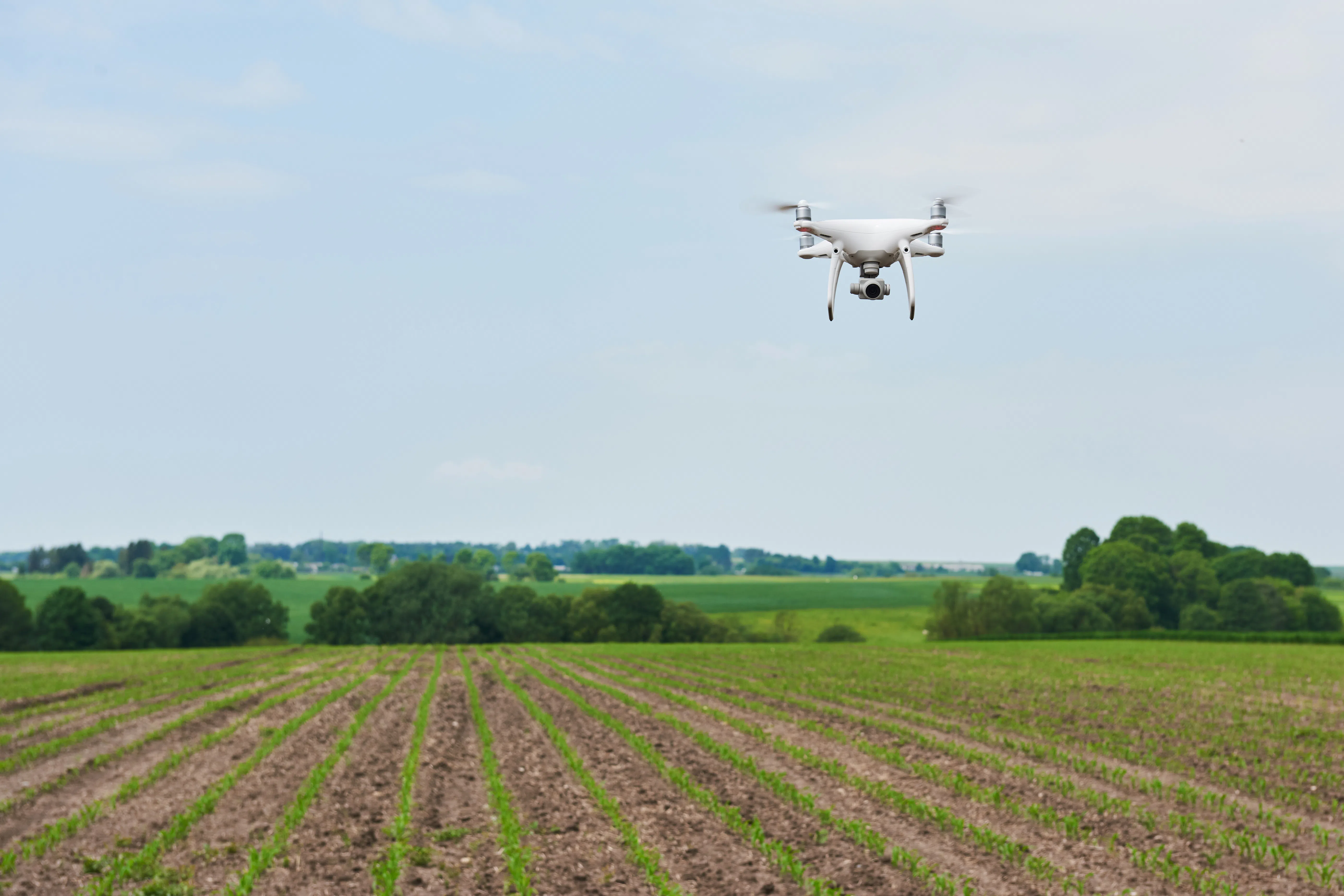
We utilize advanced UAV systems to support mapping, inspection, and data collection across a wide range of applications.

Our pilots are certified by Transport Canada for Advanced Operations, including Level 1 Complex Operations, allowing us to safely operate in complex environments when required. By combining aerial data capture with our GIS and locating expertise, we deliver accurate, efficient, and safe solutions for our clients.

UAV & Mapping Services Intro
Flare Stack Visual Inspections

FLARE STACK
VISUAL INSPECTIONS

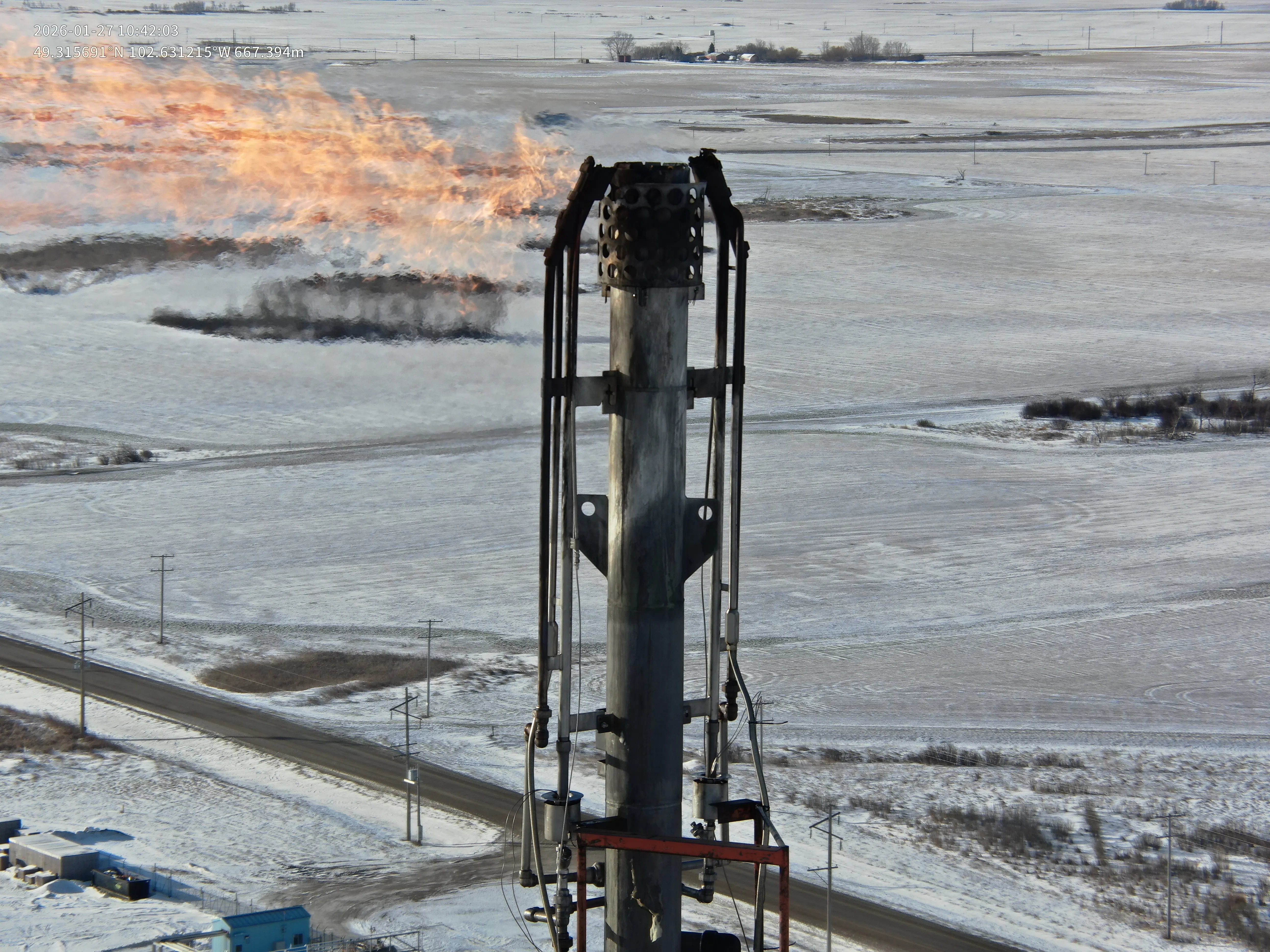
We provide UAV-based visual inspections of flare stacks and elevated infrastructure.

Using high-resolution cameras with digital zoom capabilities, we are able to closely inspect flare tips, stack structure, and other hard-to-reach components without the need for climbing or specialized access equipment. This allows for detailed identification of corrosion, damage, wear, and other potential issues while significantly reducing risk to personnel.

Inspections are documented with high-resolution images and video, providing clear visual records to support maintenance planning and operational decision-making.

2D & 3D MAPPING
SERVICES

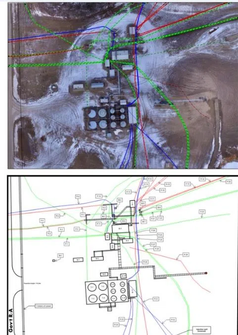
We provide high-resolution 2D orthomosaic imagery and 3D models of facilities and project sites.

Using UAV-collected imagery and advanced processing workflows, we generate geo-referenced maps that integrate seamlessly with GIS platforms. These maps provide accurate, up-to-date visual context, showing infrastructure in relation to buildings, equipment, and surrounding site features. For projects requiring higher positional accuracy, ground control points (GCPs) can be established to improve spatial accuracy and ensure data meets project-specific requirements.

Mapping outputs can be used for plot plans, site layouts, and operational planning, with deliverables available in both digital formats and large-scale printed maps.

2D & 3D Mapping - Point Cloud & CAD
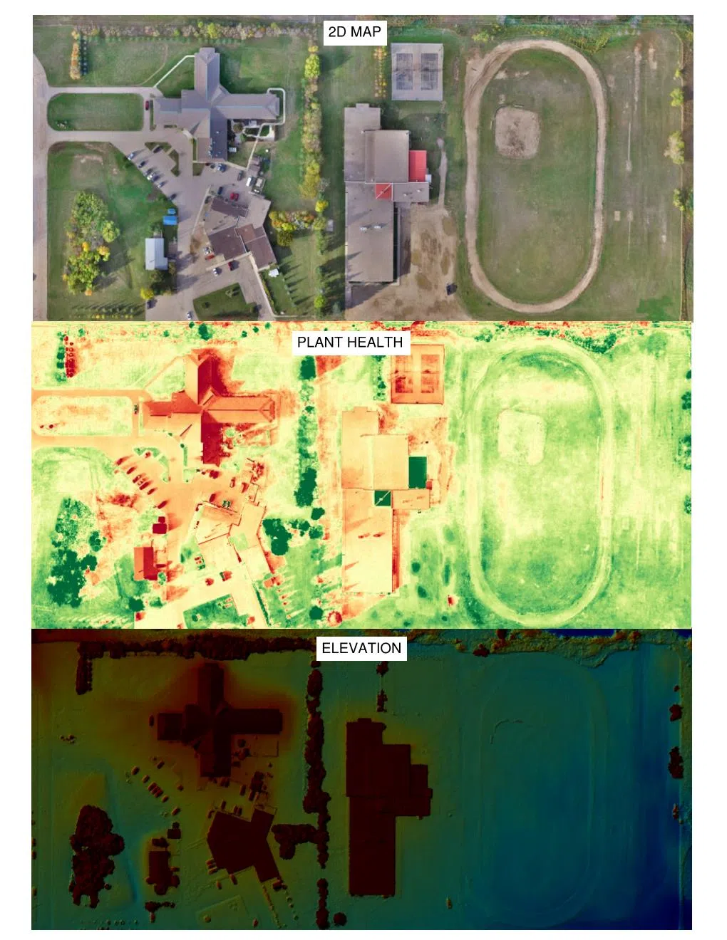
Orthomosaic Layers Map

In addition to 2D imagery, we can provide elevation data, plant health analysis, and other visual datasets to support site analysis and monitoring.

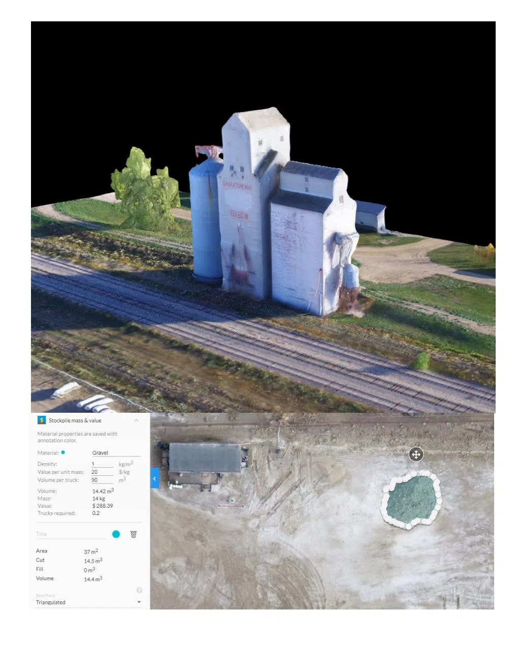
3D models allow for enhanced visualization of site conditions and can be used to measure distances, areas, elevations, and volumes with a high degree of accuracy.

3D Silo Stockpile Model

VOLUME
CALCULATIONS

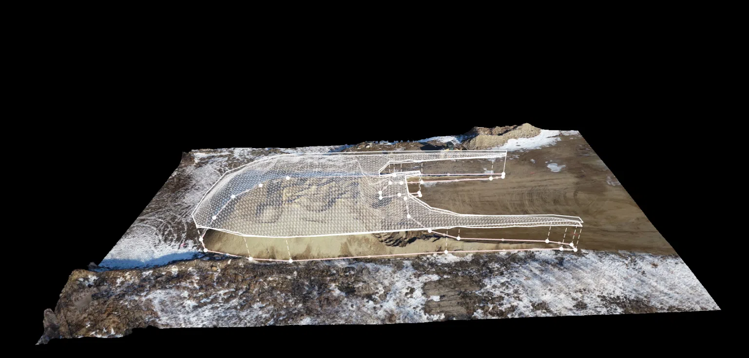
We provide accurate volume calculations for stockpiles and site grading using UAV-generated 3D models.

By capturing aerial imagery and processing it into detailed surface and elevation models, we are able to calculate volumes for materials such as gravel, soil, and other aggregates with a high degree of accuracy. This includes cut and fill analysis for pits, pads, and other site developments, allowing clients to track material movement and quantify changes over time.

For projects requiring higher positional accuracy, ground control points (GCPs) can be incorporated to improve overall measurement accuracy.

This method eliminates the need for manual surveying, reducing time, labour, and potential error while providing fast and reliable results. Volume calculations can be used for inventory tracking, project planning, and verification of material quantities. Material densities can be incorporated where provided to support conversion to weight-based measurements.
Volume Calculations
Site-Specific Emergency Response Plans

SITE-SPECIFIC EMERGENCY
RESPONSE PLANS

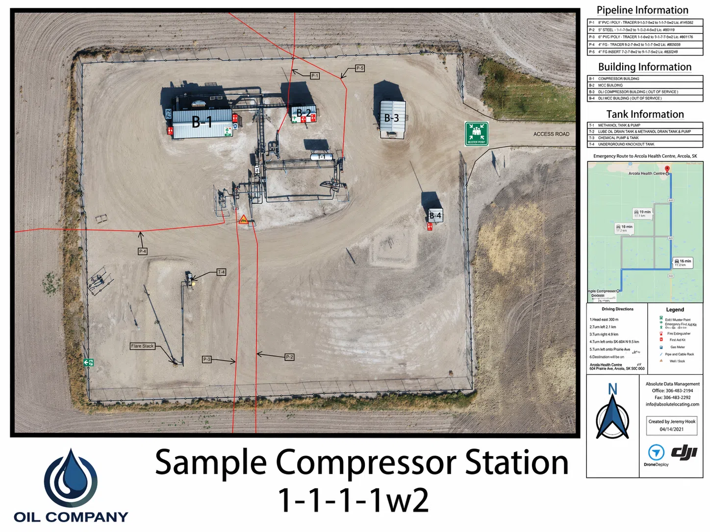
We use UAV-generated high-resolution imagery to develop site-specific Emergency Response Plans.

These plans clearly identify critical site features such as emergency equipment locations, access routes, muster points, and surrounding infrastructure.

Additional information, including directions to nearby hospitals and emergency responders, can be incorporated to support rapid response in emergency situations. High-resolution imagery provides a clear and current visual reference of the site, improving situational awareness and ensuring responders have accurate information when it is needed most.

Plans can be delivered in digital formats or printed as large-format maps, including Arch E wall-sized prints for use on-site.

CALL
BEFORE
YOU DIG.

MAKE THE CALL.

Sask 1st Call is a “Call Before You Dig” location screening and notification service for contractors and customers who are planning to dig or excavate.

Calling Sask 1st Call will proactively alert the Sask 1st Call subscriber companies of plans to disturb the ground. Sask 1st Call will issue line locate request notifications to subscriber companies to ensure that underground facilities are clearly marked before work starts.

First Call organizations enhance safety to the public and digging community as well as reduce damage and associated costs to underground facilities.

Call 1 (866) 828-4888 or go online to place your 1st Call.